
Republic of Mauritius
République de Maurice
République de Maurice
Government type Parliamentary republic
Area 2,007 km² (775 sq mi)
Population 1,235,000 inh. (2022 census)
Population 1,242,000 inh. (2026 est.)
Population density 619 inh/km² (1,603 inh/mi²)
Area 2,007 km² (775 sq mi)
Population 1,235,000 inh. (2022 census)
Population 1,242,000 inh. (2026 est.)
Population density 619 inh/km² (1,603 inh/mi²)
Capital Port Louis (140,000 pop.)
Currency Mauritian rupee
Human development index 0.806 (73rd place)
Languages English, French (official), Mauritian Creole, Hindi
Life expectancy M 70 years, F 77 years
Currency Mauritian rupee
Human development index 0.806 (73rd place)
Languages English, French (official), Mauritian Creole, Hindi
Life expectancy M 70 years, F 77 years
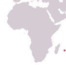
Boundaries:
Surrounded by the Indian Ocean
GEOGRAPHY DATA OF MAURITIUS
Largest cities
Port Louis 140,000 pop.
Vacoas/Phoenix 107,000 pop.
Beau Bassin/Rose Hill 92,000 pop.
Highest mountains
Piton de la Petite Rivière Noire 828 m (2,717 ft)
Longest rivers
Grand River South East 40 km (25 mi)
Largest islands
Mauritius 1,865 km² (720 sq mi)
Rodrigues 108 km² (42 sq mi)
Agaléga Islands 27 km² (10.5 sq mi)
ADMINISTRATIVE DIVISIONS OF MAURITIUS
Mauritius is administratively divided into 9 districts, with that of Flacq, located in the central-eastern part of the island, which is the largest, while the district of Plaines Wilhems is the most populated, with almost 30% of the inhabitants of the Country; other islands are also part of the territory: Rodrigues, the two Agaléga islands and the archipelago of Saint Brandon.All the major inhabited centers are located in the central-western part of the territory, with the towns on the eastern coast less populous, while the southern part of the country has no significant urban centers.