
Democratic Republic of São Tomé and Príncipe
República Democrática de São Tomé e Principe
República Democrática de São Tomé e Principe
Government type Semi-presidential republic
Area 1,001 km² (386 sq mi)
Population 209,600 inh. (2024 census)
Population density 209 inh/km² (543 inh/mi²)
Area 1,001 km² (386 sq mi)
Population 209,600 inh. (2024 census)
Population density 209 inh/km² (543 inh/mi²)
Capital São Tomé (78,000 pop.)
Currency São Tomé and Principe dobra
Human development index 0.637 (141st place)
Languages Portuguese (official), Creole
Life expectancy M 66 years, F 73 years
Currency São Tomé and Principe dobra
Human development index 0.637 (141st place)
Languages Portuguese (official), Creole
Life expectancy M 66 years, F 73 years
Boundaries:
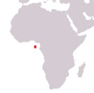
Surrounded by the Atlantic Ocean
GEOGRAPHY DATA OF SÃO TOMÉ AND PRINCIPE
Largest cities
São Tomé 78,000 pop.
Neves 8,400 pop.
Highest mountains
Pico de São Tomé 2,024 m (6,640 ft)
Largest islands
São Tomé 854 km² (330 sq mi)
Principe 136 km² (53 sq mi)