
Republic of Malta
Repubblika ta' Malta
Repubblika ta' Malta
Government type Parliamentary republic
Area 316 km² (122 sq mi)
Population 520,000 inh. (2021 census)
Population 590,000 inh. (2026 est.)
Population density 1,867 inh/km² (4,836 inh/mi²)
Area 316 km² (122 sq mi)
Population 520,000 inh. (2021 census)
Population 590,000 inh. (2026 est.)
Population density 1,867 inh/km² (4,836 inh/mi²)
Capital Valletta (5,200 pop., 280,000 urban aggl.)
Currency Euro
Human development index 0.924 (24th place)
Languages English, Maltese (both official)
Life expectancy M 81 years, F 85 years
Currency Euro
Human development index 0.924 (24th place)
Languages English, Maltese (both official)
Life expectancy M 81 years, F 85 years
Boundaries:
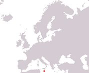
Surrounded by the Mediterranean Sea
GEOGRAPHY DATA OF MALTA
Largest cities
St Paul's Bay 40,200 pop.
Birkirkara 29,500 pop.
Mosta 25,500 pop.
Sliema 22,700 pop.
Qormi 20,000 pop.
Highest mountains
Ta' Dmejrek 253 m (830 ft)
Largest islands
Malta 246 km² (95 sq mi)
Gozo 67 km² (26 sq mi)