
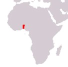
Republic of Benin
République du Bénin
République du Bénin
Government type Presidential republic
Area 114,763 km² (44,310 sq mi)
Population 10,009,000 inh. (2013 census)
Population 15,170,000 inh. (2026 est.)
Population density 132 inh/km² (342 inh/mi²)
Area 114,763 km² (44,310 sq mi)
Population 10,009,000 inh. (2013 census)
Population 15,170,000 inh. (2026 est.)
Population density 132 inh/km² (342 inh/mi²)
Capital Porto-Novo (320,000 pop., 690,000 urban aggl.)
Currency West African CFA franc
Human development index 0.515 (173rd place)
Languages French (official), regional languages
Life expectancy M 63 years, F 66 years
Currency West African CFA franc
Human development index 0.515 (173rd place)
Languages French (official), regional languages
Life expectancy M 63 years, F 66 years
GEOGRAPHY DATA OF BENIN
Largest cities
Cotonou 780,000 pop., 2,007,000 urban aggl.
Porto-Novo 320,000 pop., 690,000 urban aggl.
Parakou 255,000 pop.
Godomey 253,000 pop.
Highest mountains
Mount Sokbaro 658 m (2,159 ft)
Longest rivers
Niger 4,180 km (2,597 mi) total, 150 km (93 mi) in Benin
Ouémé 510 km (317 mi)
Largest lakes
Lake Nokoué 160 km² (62 sq mi)
Lake Ahémé 78 km² (30 sq mi)
ADMINISTRATIVE DIVISIONS OF BENIN
Benin is administratively divided into 12 departments, with that of the Littoral corresponding to the city of Cotonou; the two north-eastern departments of Alibori and Borgou are those with the greatest territorial extension, while the Atlantique, despite having an area of only just over 3,000 square kilometers, is the most populated department.The area between Cotonou and Porto-Novo includes 5 of the most important cities in the country; as can be seen from the second map, the distribution of the major urban centers is however quite homogeneous.