
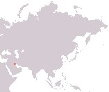
State of Kuwait
Dawlat al-Kuwayt
Dawlat al-Kuwayt
Government type Hereditary constitutional monarchy
Area 17,818 km² (6,880 sq mi)
Population 4,386,000 inh. (2021 census)
Population 5,025,000 inh. (2026 est.)
Population density 282 inh/km² (730 inh/mi²)
Area 17,818 km² (6,880 sq mi)
Population 4,386,000 inh. (2021 census)
Population 5,025,000 inh. (2026 est.)
Population density 282 inh/km² (730 inh/mi²)
Capital Kuwait City (575,000 pop., 4,055,000 urban aggl.)
Currency Kuwaiti dinar
Human development index 0.852 (52nd place)
Languages Arabic (official), English
Life expectancy M 80 years, F 82 years
Currency Kuwaiti dinar
Human development index 0.852 (52nd place)
Languages Arabic (official), English
Life expectancy M 80 years, F 82 years
GEOGRAPHY DATA OF KUWAIT
Largest cities
Hawalli 957,000 pop., 4,055,000 urban aggl., largest city in the agglomeration of the capital Kuwait City
Al-Farwaniyah 893,000 pop.
Al-Fintas 516,000 pop.
Highest elevation
306 m (1,004 ft) near the western edge of the country
Longest rivers
Only non-permanent rivers
Largest lakes
Only non-permanent lakes
Largest islands
Bubiyan 863 km² (333 sq mi)
ADMINISTRATIVE DIVISIONS OF KUWAIT
Kuwait is administratively divided into 6 governorates, with those of Al Jahrah and Al Ahmadi making up 97% of the territory, although that of Al Farwaniyah, much smaller, has a greater number of inhabitants.All major cities are located along the coastal strip on the Persian Gulf and are practically part of a single large urban agglomeration around the capital Al-Kuwait.