
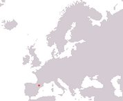
Principality of Andorra
Principat dAndorra
Principat dAndorra
Government type Parliamentary co-principality
Area 468 km² (181 sq mi)
Population 89,100 inh. (2026 est.)
Population density 190 inh/km² (492 inh/mi²)
Area 468 km² (181 sq mi)
Population 89,100 inh. (2026 est.)
Population density 190 inh/km² (492 inh/mi²)
Capital Andorra la Vella (21,500 pop.)
Currency Euro
Human development index 0.913 (32nd place)
Languages Catalan (official), Spanish, French, Portuguese
Life expectancy M 81 years, F 85 years
Currency Euro
Human development index 0.913 (32nd place)
Languages Catalan (official), Spanish, French, Portuguese
Life expectancy M 81 years, F 85 years
GEOGRAPHY DATA OF ANDORRA
Largest cities
Andorra la Vella 21,500 pop.
Escaldes-Engordany 16,200 pop.
Encamp 8,800 pop.
Sant Julià de Lòria 8,300 pop.
Highest mountains
Coma Pedrosa 2,942 m (9,652 ft)
Longest rivers
Gran Valira 44 km (27 mi)
Largest lakes
Estany de Juclar 0.21 km² (0.08 sq mi)