
Kingdom of Spain
Reino de España
Reino de España
Government type Parliamentary constitutional monarchy
Area 505,983 km² (195,361 sq mi)
Population 47,401,000 inh. (2021 census)
Population 49,792,000 inh. (2026 est.)
Population density 98 inh/km² (255 inh/mi²)
Area 505,983 km² (195,361 sq mi)
Population 47,401,000 inh. (2021 census)
Population 49,792,000 inh. (2026 est.)
Population density 98 inh/km² (255 inh/mi²)
Capital Madrid (3,477,000 pop., 6,966,000 urban aggl.)
Currency Euro
Human development index 0.918 (28th place)
Languages Spanish (official), Catalan, Galician, Basque, Valencian (all official in their respective regions: Catalonia, Galicia, Basque Country and Valencian Community)
Life expectancy M 81 years, F 86 years
Currency Euro
Human development index 0.918 (28th place)
Languages Spanish (official), Catalan, Galician, Basque, Valencian (all official in their respective regions: Catalonia, Galicia, Basque Country and Valencian Community)
Life expectancy M 81 years, F 86 years

GEOGRAPHY DATA OF SPAIN
Largest cities
Madrid 3,477,000 pop., 6,966,000 urban aggl.
Barcelona 1,713,000 pop., 5,489,000 urban aggl.
Valencia 842,000 pop., 1,588,000 urban aggl.
Zaragoza 699,000 pop., 735.000 urban aggl.
Seville 689,000 pop., 1,169,000 urban aggl.
Malaga 597,000 pop., 722,000 urban aggl.
Murcia 478,000 pop.
Palma 443,000 pop., 560,000 urban aggl.
Las Palmas 384,000 pop., 649,000 urban aggl.
Alicante 366,000 pop.
Bilbao 351,000 pop., 785,000 urban aggl.
Córdoba 324,000 pop.
Valladolid 302,000 pop.
Highest mountains
Pico de Teide 3,718 m (12,198 ft)
Mulhacén 3,480 m (11,417 ft)
Aneto 3,404 m (11,168 ft)
Longest rivers
Tagus 1,007 km (626 mi) total, 790 km (491 mi) in Spain
Ebro 910 km (565 mi)
Douro 895 km (556 mi) total, 700 km (435 mi) in Spain
Guadiana 818 km (508 mi) total, including the final part in Portugal
Guadalquivir 657 km (408 mi)
Largest lakes
Embalse de La Serena (artificial) 139 km² (54 sq mi)
Sanabria Lake 3.7 km² (1.4 sq mi)
Largest islands
Mallorca 3,604 km² (1,392 sq mi)
Tenerife 2,034 km² (785 sq mi)
Fuerteventura 1,656 km² (639 sq mi)
Gran Canaria 1,560 km² (602 sq mi)
Lanzarote 806 km² (311 sq mi)
La Palma 708 km² (273 sq mi)
Minorca 693 km² (268 sq mi)
Ibiza 567 km² (219 sq mi)
ADMINISTRATIVE DIVISIONS OF SPAIN
Spain is administratively divided into 17 autonomous communities and the 2 autonomous cities of Ceuta and Melilla, located in Africa along the coast of Morocco on the Mediterranean Sea; Castile and León and Andalusia are the two largest regions, with the second being also the most populated in front of Catalonia and Madrid.The second administrative level is made up of the provinces, 50 overall; as can be seen from the second map, 15 provinces have at least 1 million inhabitants, with Madrid and Barcelona even exceeding the 5 million mark.
In Spain there are 6 cities with at least half a million inhabitants; the distribution of the population is quite homogeneous, with many of the major urban centers located along the sea or not far from it, with the exception of Madrid and Zaragoza.
Madrid
Photos
(click to enlarge)
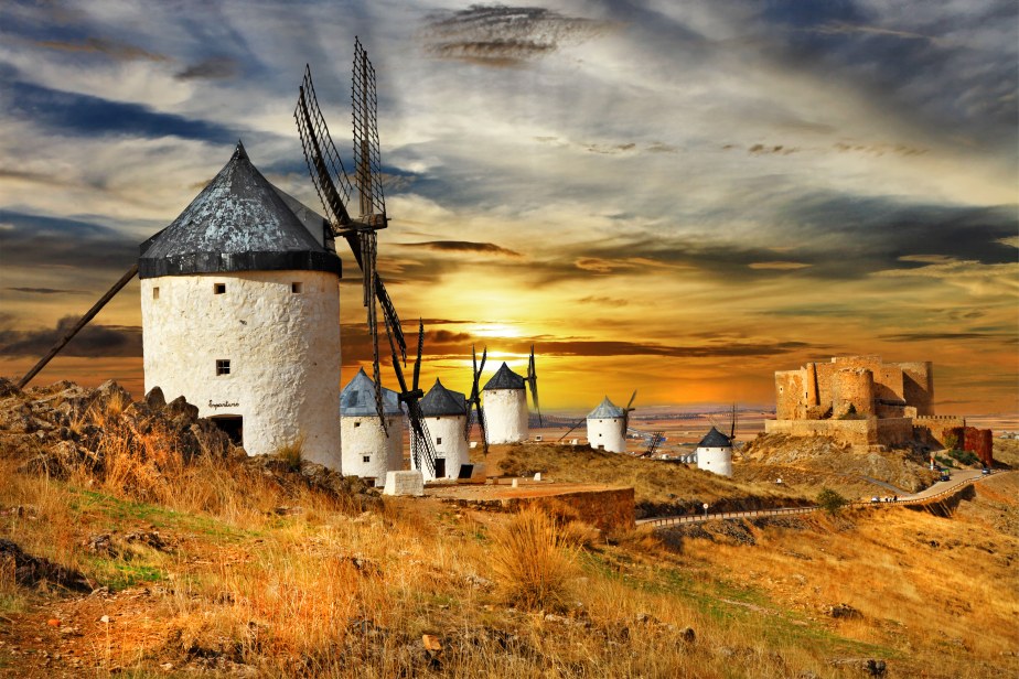
Consuegra, La Mancia
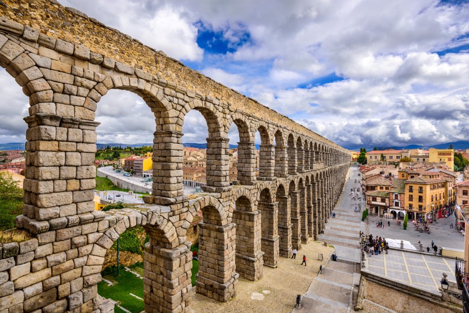
Segovia
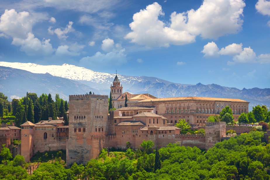
Granada, Alhambra
» See the full album
(18 photos)
Useful links
Instituto Nacional de EstadisticaSpanish Tourism