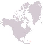
Home > North America > Antigua and Barbuda

Antigua and Barbuda
Government type Parliamentary constitutional monarchy
Area 442 km² (171 sq mi)
Population 84,800 inh. (2011 census)
Population 106,400 inh. (2026 est.)
Population density 241 inh/km² (622 inh/mi²)
Area 442 km² (171 sq mi)
Population 84,800 inh. (2011 census)
Population 106,400 inh. (2026 est.)
Population density 241 inh/km² (622 inh/mi²)
Capital Saint John's (21,600 pop.)
Currency Eastern Caribbean dollar
Human development index 0.851 (53rd place)
Languages English (official), Creole-English
Life expectancy M 76 years, F 81 years
Currency Eastern Caribbean dollar
Human development index 0.851 (53rd place)
Languages English (official), Creole-English
Life expectancy M 76 years, F 81 years
Boundaries:
Surrounded by the Atlantic Ocean
GEOGRAPHY DATA OF ANTIGUA AND BARBUDA
Largest cities
Saint John's 21,600 pop.
All Saints 3,400 pop.
Highest mountains
Boggy Peak 402 m (1,319 ft)
Largest islands
Antigua 280 km² (108 sq mi)
Barbuda 160 km² (62 sq mi)
Redonda 1.6 km² (0.6 sq mi)