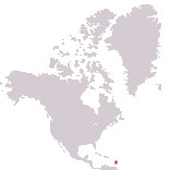
Home > North America > Dominica

Commonwealth of Dominica
Government type Parliamentary republic
Area 751 km² (290 sq mi)
Population 65,500 inh. (2026 est.)
Population density 87 inh/km² (226 inh/mi²)
Area 751 km² (290 sq mi)
Population 65,500 inh. (2026 est.)
Population density 87 inh/km² (226 inh/mi²)
Capital Roseau (14,700 pop.)
Currency Eastern Caribbean dollar
Human development index 0.761 (98th place)
Languages English (official), Creole-French
Life expectancy M 74 years, F 80 years
Currency Eastern Caribbean dollar
Human development index 0.761 (98th place)
Languages English (official), Creole-French
Life expectancy M 74 years, F 80 years
Boundaries:
Surrounded by the Atlantic Ocean
GEOGRAPHY DATA OF DOMINICA
Largest cities
Roseau 14,700 pop.
Portsmouth 4,200 pop.
Highest mountains
Morne Diablotins 1,447 m (4,747 ft)
Largest lakes
Freshwater Lake 0.04 km² (0.015 sq mi)
Largest islands
Dominica 751 km² (290 sq mi)
ADMINISTRATIVE DIVISIONS OF DOMINICA
Dominica is administratively divided into 10 parishes, with that of Saint Andrew being the largest, while the parish of Saint George, where the capital is located, is the most populated.Only the capital Roseau has more than 10,000 inhabitants, while all the other towns remain under 5,000 people and are mostly located on the west coast.