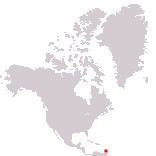
Home > North America > Saint Lucia

Saint Lucia
Government type Parliamentary constitutional monarchy
Area 617 km² (238 sq mi)
Population 172,900 inh. (2022 census)
Population 176,000 inh. (2026 est.)
Population density 285 inh/km² (739 inh/mi²)
Area 617 km² (238 sq mi)
Population 172,900 inh. (2022 census)
Population 176,000 inh. (2026 est.)
Population density 285 inh/km² (739 inh/mi²)
Capital Castries (22,000 pop.)
Currency Eastern Caribbean dollar
Human development index 0.748 (103rd place)
Languages English (official), Creole-French
Life expectancy M 75 years, F 77 years
Currency Eastern Caribbean dollar
Human development index 0.748 (103rd place)
Languages English (official), Creole-French
Life expectancy M 75 years, F 77 years
Boundaries:
Surrounded by the Atlantic Ocean
GEOGRAPHY DATA OF SAINT LUCIA
Largest cities
Castries 22,000 pop.
Vieux Fort 5,000 pop.
Highest mountains
Mount Gimie 950 m (3,117 ft)
Longest rivers
Roseau 21 km (13 mi)
Largest islands
Saint Lucia 616 km² (238 sq mi)
Maria Island 0.10 km² (0.04 sq mi)