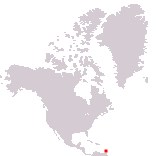
Home > North America > Saint Vincent and the Grenadines

Saint Vincent and the Grenadines
Government type Parliamentary constitutional monarchy
Area 389 km² (150 sq mi)
Population 101,300 inh. (2023 census)
Population 99,300 inh. (2026 est.)
Population density 255 inh/km² (662 inh/mi²)
Area 389 km² (150 sq mi)
Population 101,300 inh. (2023 census)
Population 99,300 inh. (2026 est.)
Population density 255 inh/km² (662 inh/mi²)
Capital Kingstown (13,000 pop.)
Currency Eastern Caribbean dollar
Human development index 0.798 (76th place)
Languages English (official), Creole-English, Patois (Creole-French dialect)
Life expectancy M 69 years, F 74 years
Currency Eastern Caribbean dollar
Human development index 0.798 (76th place)
Languages English (official), Creole-English, Patois (Creole-French dialect)
Life expectancy M 69 years, F 74 years
Boundaries:
Surrounded by the Atlantic Ocean
GEOGRAPHY DATA OF SAINT VINCENT AND THE GRENADINES
Largest cities
Kingstown 13,000 pop.
Highest mountains
La Soufriere 1,234 m (4,049 ft)
Largest lakes
Crater Lake
Longest rivers
Colonarie
Largest islands
Saint Vincent 343 km² (132 sq mi)
Bequia 17 km² (6.6 sq mi)
Union Island 9 km² (3.5 sq mi)
Canouan 7.6 km² (2.9 sq mi)
Mustique 5.7 km² (2.2 sq mi)