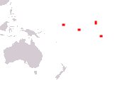
Republic of Kiribati
Ribaberiki Kiribati
Ribaberiki Kiribati
Government type Parliamentary republic
Area 811 kmē (313 sq mi)
Population 119,000 inh. (2020 census)
Population 132,000 inh. (2026 est.)
Population density 163 inh/kmē (422 inh/miē)
Area 811 kmē (313 sq mi)
Population 119,000 inh. (2020 census)
Population 132,000 inh. (2026 est.)
Population density 163 inh/kmē (422 inh/miē)
Capital South Tarawa (63,100 pop.)
Currency Australian dollar, Kiribati dollar
Human development index 0.644 (140th place)
Languages Gilbertese, English (both official)
Life expectancy M 66 years, F 70 years
Currency Australian dollar, Kiribati dollar
Human development index 0.644 (140th place)
Languages Gilbertese, English (both official)
Life expectancy M 66 years, F 70 years

Boundaries:
Surrounded by the Pacific Ocean
GEOGRAPHY DATA OF KIRIBATI
Largest cities
South Tarawa 63,100 pop.
Highest elevation
81 m (266 ft) on Banaba Island
Largest islands
Kiritimati 388 kmē (150 sq mi)
Malden 39 kmē (15 sq mi)
Tabiteuea 38 kmē (14.7 sq mi)
Tabuaeran 34 kmē (13.1 sq mi)
Tarawa 31 kmē (12 sq mi)
Abemama 27 kmē (10.4 sq mi)
