
Federated States of Micronesia
Government type Federal parliamentary republic
Area 702 km² (271 sq mi)
Population 102,800 inh. (2010 census)
Population 113,900 inh. (2026 est.)
Population density 162 inh/km² (420 inh/mi²)
Area 702 km² (271 sq mi)
Population 102,800 inh. (2010 census)
Population 113,900 inh. (2026 est.)
Population density 162 inh/km² (420 inh/mi²)
Capital Palikir (7,100 pop.)
Currency United States dollar
Human development index 0.615 (149th place)
Languages English (official), Austronesian languages
Life expectancy M 66 years, F 71 years
Currency United States dollar
Human development index 0.615 (149th place)
Languages English (official), Austronesian languages
Life expectancy M 66 years, F 71 years
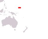
Boundaries:
Surrounded by the Pacific Ocean
GEOGRAPHY DATA OF MICRONESIA
Largest cities
Weno 13,400 pop.
Palikir 7,100 pop.
Highest mountains
Mount Dolohmwar 791 m (2,595 ft)
Largest islands
Pohnpei 334 km² (129 sq mi)
Kosrae 109 km² (42 sq mi)
Chuuk 101 km² (39 sq mi)