
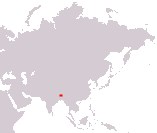
Kingdom of Bhutan
Druk Gyalkhap
Druk Gyalkhap
Government type Parliamentary monarchy
Area 38,394 km² (14,824 sq mi)
Population 727,000 inh. (2017 census)
Population 791,000 inh. (2026 est.)
Population density 21 inh/km² (53 inh/mi²)
Area 38,394 km² (14,824 sq mi)
Population 727,000 inh. (2017 census)
Population 791,000 inh. (2026 est.)
Population density 21 inh/km² (53 inh/mi²)
Capital Thimphu (135,000 pop.)
Currency Bhutanese ngultrum
Human development index 0.698 (125th place)
Languages Dzongkha (official), tibetan and nepali languages
Life expectancy M 70 years, F 72 years
Currency Bhutanese ngultrum
Human development index 0.698 (125th place)
Languages Dzongkha (official), tibetan and nepali languages
Life expectancy M 70 years, F 72 years
GEOGRAPHY DATA OF BHUTAN
Largest cities
Thimphu 135,000 pop.
Phuntsholing 27,700 pop.
Highest mountains
Gangkar Puensum 7,570 m (24,836 ft)
Kula Kangri 7,538 m (24,731 ft)
Longest rivers
Manas 376 km (234 mi) total, 272 km (169 mi) in Bhutan
ADMINISTRATIVE DIVISIONS OF BHUTAN
Bhutan is administratively divided into 20 districts; Wangdue Phodrang, with an area close to 4,000 square kilometers, is the largest district, while that of Thimpu is the most populated and sole with over one hundred thousand inhabitants.Apart from the capital Thimphu and to a lesser extent Phuntsholing, all the other main inhabited centers are villages with a few thousand inhabitants; it can be seen from the second map that these urban centers are located either in the area of the capital or near the border with India, where the territory is flatter.