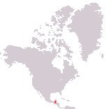
Home > North America > Belize

Belize
Government type Parliamentary constitutional monarchy
Area 22,965 km² (8,867 sq mi)
Population 397,000 inh. (2022 census)
Population 429,000 inh. (2026 est.)
Population density 19 inh/km² (48 inh/mi²)
Area 22,965 km² (8,867 sq mi)
Population 397,000 inh. (2022 census)
Population 429,000 inh. (2026 est.)
Population density 19 inh/km² (48 inh/mi²)
Capital Belmopan (20,800 pop.)
Currency Belize dollar
Human development index 0.721 (115th place)
Languages English (official), Spanish, Creole-English, Mayan languages
Life expectancy M 72 years, F 78 years
Currency Belize dollar
Human development index 0.721 (115th place)
Languages English (official), Spanish, Creole-English, Mayan languages
Life expectancy M 72 years, F 78 years
GEOGRAPHY DATA OF BELIZE
Largest cities
Belize City 64,000 pop.
Belmopan 20,800 pop.
San Pedro 15,500 pop.
Highest mountains
Doyle's Delight 1,124 m (3,688 ft)
Longest rivers
Belize (with Mopan) 290 km (180 mi) total, including the section in Guatemala
Largest islands
Douglas Cay 65 km² (25 sq mi)
Ambergris Caye 64 km² (24.5 sq mi)
ADMINISTRATIVE DIVISIONS OF BELIZE
Belize is administratively divided into 6 districts, with that of Cayo, where the capital is located, which is the largest and the second most populated after Belize, which can count on the largest city in the country.The country has only one true city, Belize City, and 12 other less populated towns, with the rest of the population living in even smaller villages.