Home > South America > Chile

Republic of Chile
República de Chile
República de Chile
Government type Presidential republic
Area 756,096 km² (291,930 sq mi)
Population 19,904,000 inh. (2024 census)
Population 20,151,000 inh. (2026 est.)
Population density 27 inh/km² (69 inh/mi²)
Area 756,096 km² (291,930 sq mi)
Population 19,904,000 inh. (2024 census)
Population 20,151,000 inh. (2026 est.)
Population density 27 inh/km² (69 inh/mi²)
Capital Santiago (6,230,000 pop., 7,192,000 urban aggl.)
Currency Chilean peso
Human development index 0.878 (45th place)
Languages Spanish (official), Amerindian idioms
Life expectancy M 80 years, F 84 years
Currency Chilean peso
Human development index 0.878 (45th place)
Languages Spanish (official), Amerindian idioms
Life expectancy M 80 years, F 84 years

GEOGRAPHY DATA OF CHILE
Largest cities
Santiago 6,230,000 pop., 7,192,000 urban aggl.
Puente Alto 665,000 pop.
Antofagasta 440,000 pop.
Viña del Mar 370,000 pop., 910,000 urban aggl.
Valparaiso 315,000 pop.
Temuco 310,000 pop.
Rancagua 279,000 pop.
Concepción 245,000 pop., 884,000 urban aggl.
Highest mountains
Nevado Ojos del Salado 6,893 m (22,615 ft)
Nevado Tres Cruces 6,753 m (22,156 ft)
Llullaillaco 6,739 m (22,110 ft)
Longest rivers
Loa 440 km (273 mi)
Bío Bío 380 km (236 mi)
Largest lakes
General Carrera Lake 1,850 km² (714 sq mi) total, 970 km² (375 sq mi) in Chile
O'Higgins 1,013 km² (391 sq mi) total, 492 km² (190 sq mi) in Chile
Llanquihue 860 km² (332 sq mi)
Largest islands
Isla Grande de Tierra del Fuego 47,992 km² (18,530 sq mi) total, 29,485 km² (11,384 sq mi) in Chile
Chiloé 8,394 km² (3,241 sq mi)
Wellington 5,556 km² (2,145 sq mi)
Riesco 5,110 km² (1,973 sq mi)
Hoste 4,117 km² (1,590 sq mi)
Santa Inés 3,688 km² (1,424 sq mi)
Navarino 2,473 km² (955 sq mi)
Magdalena 2,025 km² (782 sq mi)
ADMINISTRATIVE DIVISIONS OF CHILE
Chile is divided into 16 regions, placed in sequence from north to south, all with a stretch of international border and an outlet to the sea, with the exception of the Metropolitan Region of Santiago, which does not reach the Pacific Ocean; the latter is clearly the most populated region, since it welcomes over 2/5 of Chileans, while the regions of Antofagasta and the two southernmost regions of Aisén del General Carlos Ibáñez del Campo and Magallanes y de la Antártica Chilena are the three most extended and the only over 100,000 square kilometers of surface area.29 cities exceed 100,000 inhabitants, with Santiago having over 9 times the inhabitants of the second most populous center Puente Alto, which is located in the conurbation of the capital itself; the distribution of the population is rather unbalanced towards the central regions, even if significant urban centers exist also in the more peripheral regions, especially in the northern area.
Santiago
Photos
(click to enlarge)
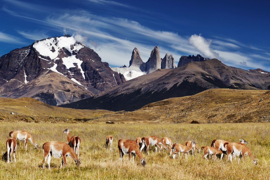
Torres del Paine, Patagonia
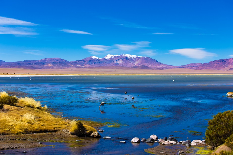
Atacama Desert
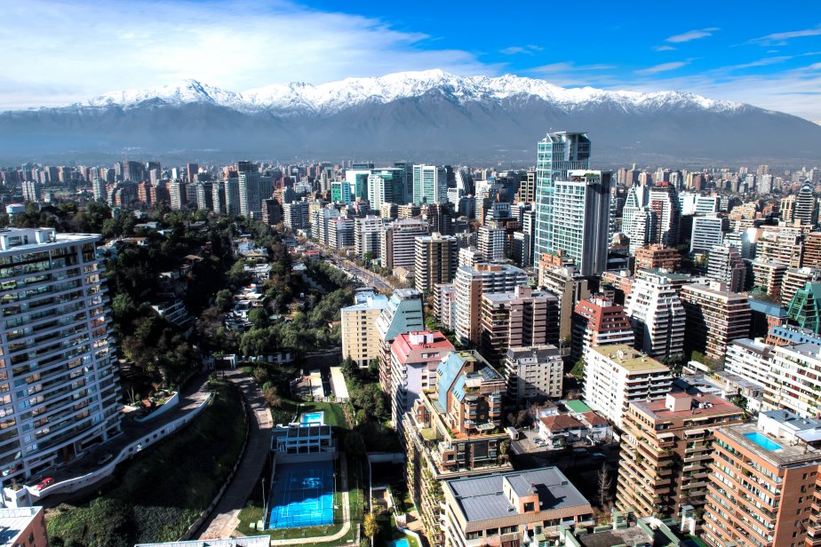
Santiago
» See the full album
(12 photos)
Useful links
Instituto Nacional de EstadísticasChile Travel