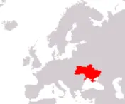
Ukraine
Ukrayina
Ukrayina
Government type Semi-presidential republic
Area 603,549 km² (233,032 sq mi)
Population 39,536,000 inh. (2026 est. - excluding Crimea and Sevastopol)
Population density 66 inh/km² (170 inh/mi²)
Area 603,549 km² (233,032 sq mi)
Population 39,536,000 inh. (2026 est. - excluding Crimea and Sevastopol)
Population density 66 inh/km² (170 inh/mi²)
Capital Kiev (2,817,000 pop.)
Currency Ukrainian hryvnia
Human development index 0.779 (87th place)
Languages Ukrainian (official), Russian
Life expectancy M 67 years, F 77 years
Currency Ukrainian hryvnia
Human development index 0.779 (87th place)
Languages Ukrainian (official), Russian
Life expectancy M 67 years, F 77 years
Note
Republic of Crimea and the city of Sevastopol have been occupied since 2014 by Russia, a country they would like to be part of, following a referendum held that same year.
GEOGRAPHY DATA OF UKRAINE
Largest cities
Kiev 2,817,000 pop.
Kharkiv 1,372,000 pop.
Odessa 1,016,000 pop., 1,081,000 urban aggl.
Dnipro 981,000 pop., 1,127,000 urban aggl.
Donetsk 905,000 pop., 1,270,000 urban aggl.
Lviv 729,000 pop.
Zaporizhzhya 697,000 pop.
Kryvyi Rih 613,000 pop.
Highest mountains
Hoverla 2,061 m (6,762 ft)
Longest rivers
Danube 2,858 km (1,776 mi) total, only a small final section is in Ukraine, marking the border with Romania
Dnieper 2,201 km (1,368 mi) total, 1,121 km (697 mi) in Ukraine
Dniester 1,370 km (851 mi) total, 925 km (575 mi) in Ukraine
Desna 1,130 km (702 mi) total, 575 km (357 mi) in Ukraine
Donets 1,053 km (654 mi) total, 700 km (435 mi) in Ukraine
Tisza 976 km (606 mi) total, first part is in Ukraine
Prut 926 km (575 mi) total, including sections in Romania and Moldova
Southern Bug 806 km (501 mi)
Bug 774 km (481 mi) total, including parts in Belarus and Poland
Psel 692 km (430 mi) total, 520 km (323 mi) in Ukraine
Horyn' 659 km (409 mi) total, 577 km (359 mi) in Ukraine
Inhulets 549 km (341 mi)
Largest lakes
Kremenchuk Reservoir (artificial) 2,250 km² (869 sq mi)
Kakhovka Reservoir (artificial) 2,155 km² (832 sq mi)
Yalpuh 149 km² (58 sq mi)
Kagul 90 km² (35 sq mi)
Kugurluy 82 km² (32 sq mi)
Largest islands
Dzharylgach 56 km² (22 sq mi)
Khortytsia 24 km² (9 sq mi)
ADMINISTRATIVE DIVISIONS OF UKRAINE
Ukraine is administratively divided into 24 regions, to which must be added the Autonomous Republic of Crimea, which is currently under Russian control and the two cities of Kiev and Sevastopol, also occupied by the Russians; the four largest and only regions to exceed 30,000 km² are, in order, those of Odessa, Dnipropetrovsk, Chernihiv and Kharkiv, while Donetsk, with just over 4 million inhabitants, is the most populated one.3 cities have more than one million inhabitants, with the capital Kiev approaching 3 million, with another 5 urban centers in the range between half a million and one million people; each region has at least one city with over 100,000 inhabitants, usually the capital, but in some eastern regions there are more relevant towns.

