
Republic of South Africa
Government type Parliamentary republic
Area 1,220,813 km² (471,359 sq mi)
Population 62,028,000 inh. (2022 census)
Population 63,186,000 inh. (2026 est.)
Population density 52 inh/km² (134 inh/mi²)
Area 1,220,813 km² (471,359 sq mi)
Population 62,028,000 inh. (2022 census)
Population 63,186,000 inh. (2026 est.)
Population density 52 inh/km² (134 inh/mi²)
Capital Pretoria (1,850,000 pop.) executive
Capital Cape Town (3,850,000 pop., 4,850,000 urban aggl.) legislative
Capital Bloemfontein (525,000 pop.) judicial
Currency South African rand
Human development index 0.741 (106th place)
Languages Afrikaans, English, Ndebele, Sepedi, Sesotho, Setswana, Swati, Tshivenda, Tsonga, Xhosa, Zulu (all official)
Life expectancy M 63 years, F 70 years

GEOGRAPHY DATA OF SOUTH AFRICA
Largest cities
Cape Town 3,850,000 pop., 4,850,000 urban aggl.
Pretoria 1,850,000 pop.
Soweto 1,380,000 pop.
Johannesburg 1,080,000 pop., 15,026,000 urban aggl.
Durban 625,000 pop., 3,527,000 urban aggl.
Port Elizabeth 335,000 pop., 1,336,000 urban aggl.
Highest mountains
Mafadi 3,450 m (11,319 ft)
Njesuthi 3,408 m (11,181 ft)
Longest rivers
Orange 2,092 km (1,300 mi) total, 1,770 km (1,100 mi) in South Africa
Limpopo 1,800 km (1,118 mi) total, 230 km (143 mi) in South Africa, marks entire border with Zimbabwe
Vaal 1,210 km (752 mi)
Molopo 1,000 km (621 mi), forms a significant section of the border with Botswana
Largest lakes
Lake Saint Lucia 350 km² (135 sq mi)
Largest islands
Marion Island 290 km² (112 sq mi)
Prince Edward Island 45 km² (17.4 sq mi)
ADMINISTRATIVE DIVISIONS OF SOUTH AFRICA
The country is divided into 9 provinces, with that of the Northern Cape which is clearly both the largest, since it alone constitutes 30% of the territory of South Africa, and the least populous, with over 1 million inhabitants; Gauteng, on the other hand, is by far the smallest province, but at the same time the most populated, with just over 15 million people.At the last census 4 cities exceeded one million inhabitants, while another 14 reached at least 200,000 people; urban centers are concentrated especially in the Johannesburg area and along the southern coastal strip, with the north-western area practically devoid of cities, due to a less favorable territory and climate than the rest of South Africa.
Pretoria
Photos
(click to enlarge)
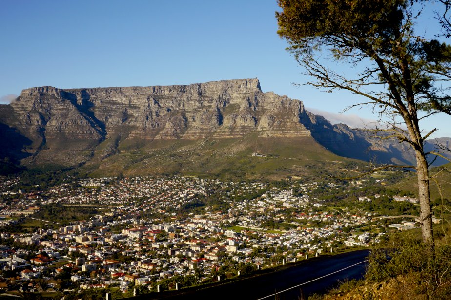
Cape Town
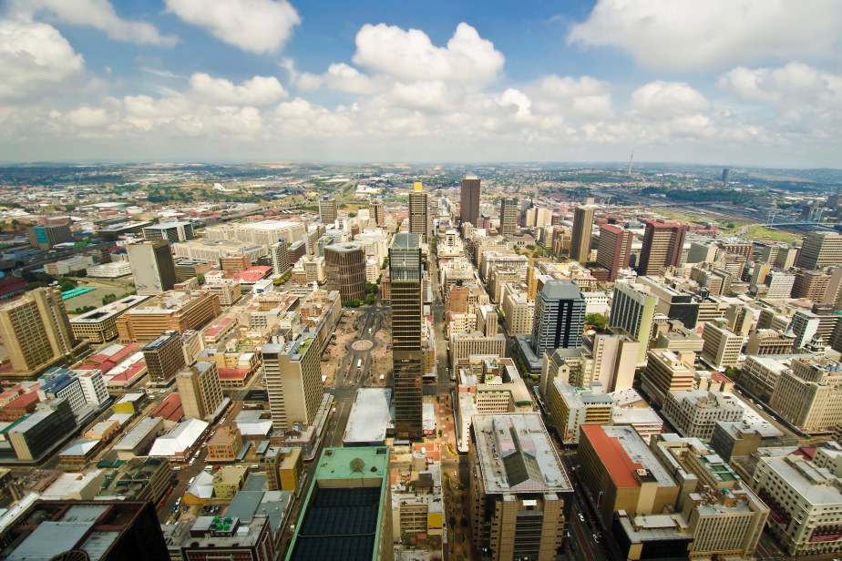
Johannesburg
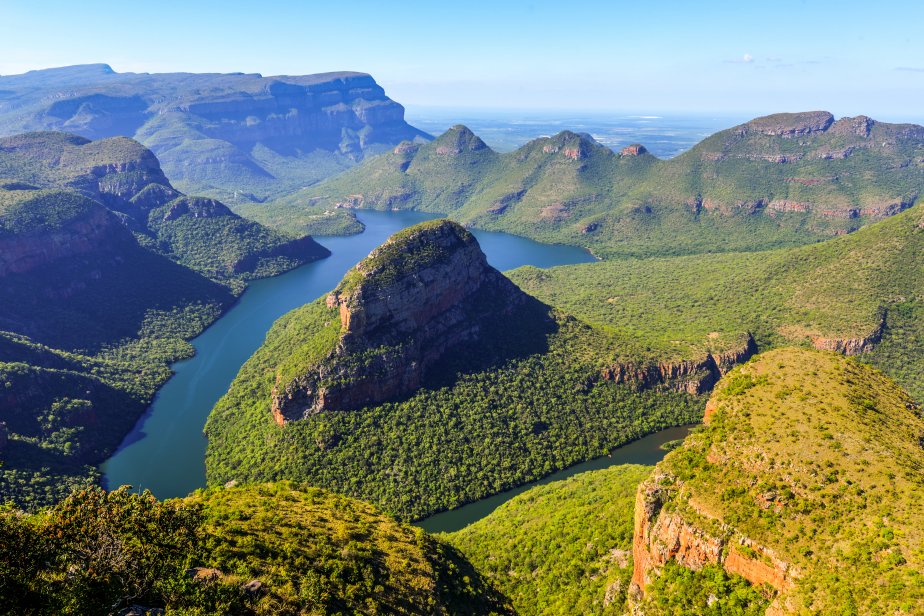
Blyde River Canyon
» See the full album
(12 photos)
Useful links
Statistics South AfricaSouth Africa's Tourism Site